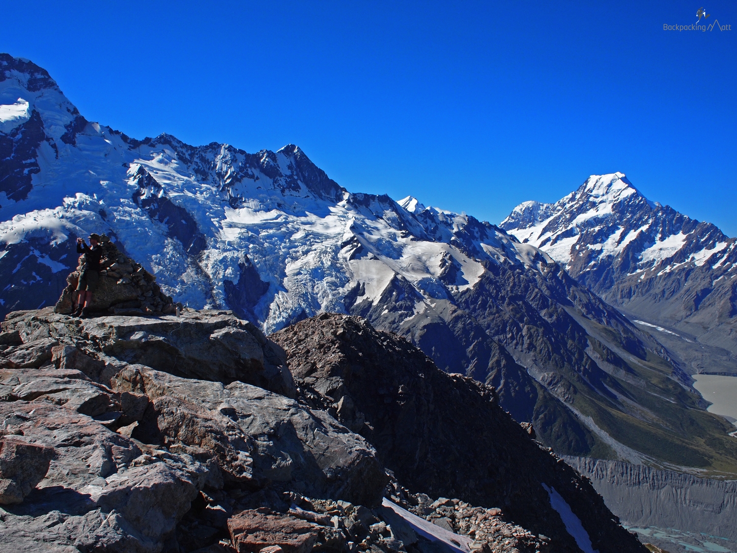
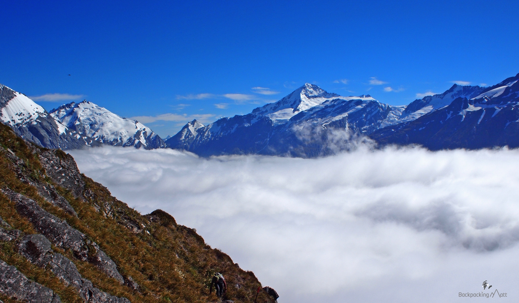
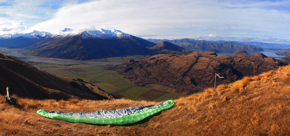
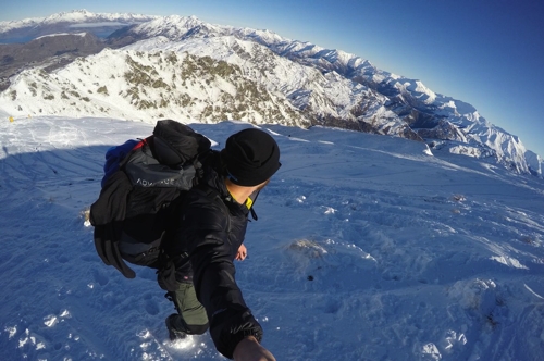
One of my biggest motivations in learning to paraglide was to be able to combine hiking with flying. I’ve always loved walking up mountains, and the allure of walking to the top and flying back to the bottom was huge. Once you’ve reached the top of the mountain, getting back down is never nearly as much fun.
I almost called this post, “A Day Walk to the Cascade Saddle,” but reconsidered at the last minute as realistically getting to Cascade Saddle isn’t a day walk. You can do it in a day, but it’s an epic one.
If there was one warning I would give someone before learning to paraglide, it wouldn’t have anything to do with the potential dangers of the sport. It would be a cautionary tale of a different variety – one that focused more on the incredibly addictive aspect of flying, and one that cautioned how paragliding can very quickly take over your life.
What follows is a guest post from a fellow Yank and friend who until very recently called New Zealand home. Jeremy has spent months exploring New Zealand and was based temporarily in Auckland, Wellington and Queenstown. He’s crossed the ditch now to Australia, and I look forward to one day again sharing a Black Shag with him at Dux de Lux on the shores of Lake Wakatipu (not as it sounds, you must visit Queenstown to understand…).
New Zealand is a land of picturesque lakes, often painted and photographed for their arresting elegance and tranquil resplendence. The raw beauty of New Zealand has remained intact over the years, its natural glory still relatively unaffected.
Aotearoa (the native Maori word for “New Zealand”) is far removed from the rest of the world and its incredible geographic history has put it on the map (and the internet!) for its astounding landscapes and scenery. Here are 7 of the Most Stunning Lakes in New Zealand.
Lake Taupo
Lake Taupo, New Zealand – North Island
Lake Taupo is located smack dab in the middle of the North Island. Not only is it New Zealand’s largest lake, but it is the largest freshwater lake in Oceana. Lake Taupo sits in a caldera of a volcano, Oruanui, which erupted 26,500 years ago. This type of volcanic formation is very typical of New Zealand’s North Island, where many volcanoes remain active.
Lake Wakatipu
Lake Wakatipu, New Zealand – South Island
Lake Wakatipu, New Zealand’s longest lake, gained its notoriety because it abuts the famous Queenstown, the adventure capital of the world. Thousands of visitors come to Queenstown each year to pump adrenaline and marvel at its scenic beauty. The Remarkables, a mountain range and ski field famous for its part in The Lord of the Rings, rises impressively behind Lake Wakatipu, creating a stunning backdrop for this natural beauty. This shot looks from Bennets Bluff towards the quaint town of Glenorchy at the head of the lake.
Lake Tekapo
Lake Tekapo, New Zealand (South Island)
Located on New Zealand’s South Island, Lake Tekapo is a popular tourist destination and, with the exception of Lake Wakatipu, it might be New Zealand’s most famous lake. Tekapo’s blazing turquoise color comes from glacial sediment that was left behind when the lake’s basin was originally formed. Lake Tekapo is fringed by the Southern Alps and, on a clear day, from the right angle, Mt. Cook, New Zealand’s tallest mountain, can be seen in the distance.
The Emerald Lakes
Emerald Lakes, New Zealand (North Island)
Embedded in its volcanic terrain, the Emerald Lakes are a part of the Tongariro Alpine Crossing, New Zealand’s most popular tramp in Tongariro National Park. This is a highly volcanic region and the landscape reflects this. The lakes, which shine an impossible emerald, have been colored by dissolved volcanic minerals. Among other things, this area also boasts lava flows, boiling hot springs and steam geysers.
Champagne Pool
Champagne Pool, New Zealand (North Island)
Wai-O-Tapu is a geothermal area in the North Island’s Bay of Plenty region. Only 30km from Rotorua, this volcanic landscape is host to boiling mud pools, geysers and multi-hued rocks and pools. The world famous Champagne Pool got its name from the effluence of carbon dioxide, hence, Champagne! Wai-O-Tapu is New Zealand’s most geothermic site.
Lake Wanaka
Lake Wanaka, New Zealand (South Island)
Left behind by a glacier from the last ice age, this charming lake sits next to the quaint town of Wanaka. Just as this small city is Queenstown’s little sister, so are the two lakes. This body of water breathes serenity, and many locals and tourists alike spend their days lounging on the gravel beach, enjoying the tranquility this lake brings.
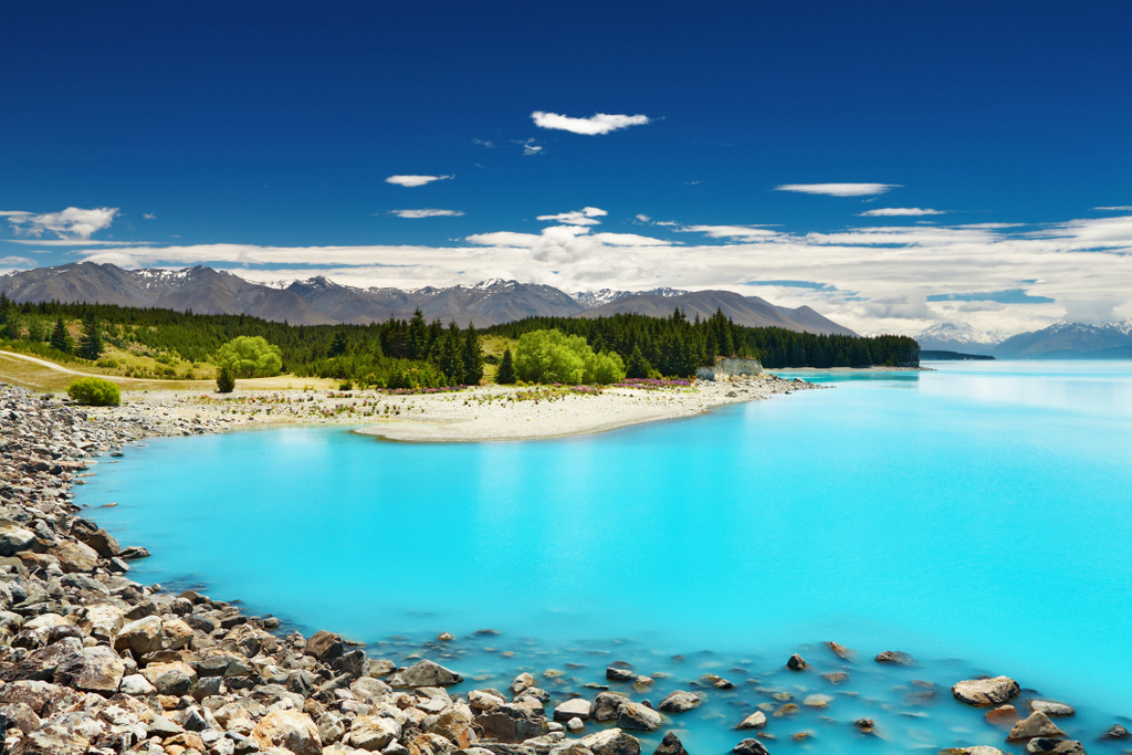
Lake Pukaki
Lake Pukaki (South Island), New Zealand
Another glacial feature of New Zealand, Lake Pukaki boasts a distinctive blue color, created by the byproduct of glacial erosion. These sediments are fed into the lake by the Tasman and Hooker Glaciers. With Mount Cook standing proudly in the background, Pukaki is one lake not to miss, its rocky shoreline creating a contrast of colors one won’t find anywhere else in the world.
As you can see, New Zealand is a vast and contrasting land of glacial and volcanic craters, formations, mountains, valleys and lakes. Its small population and a low level of tourism makes certain that, for years to come, this iconic country will remain preserved. And what a blessing that is!
Good work, New Zealand. I’m officially impressed.
Born in America, Jeremy, an IT specialist by trade, packed up his belongings and left home on an open-ended trip to Australia. Years later, he’s still on the move and exploring other countries. He is now a mobile cocktail bartender and the head writer for travelFREAK! Check out travelFREAK.net, follow Jeremy on Twitter, and love him on Facebook.
Planning a trip to New Zealand? Don’t forget to check out my Planit NZ travel guide for help in putting together the perfect itinerary.
I often wonder how an Iowa born and bred boy like myself could develop such a passion for the mountains. Needless to say, snow-capped peaks aren’t a common sight anywhere in the midwest, and this is certainly true in my homestate of Iowa.Yet after two years of living in a mountain-town on New Zealand’s South Island, I’ve developed a love for the hills – a passion for exploring, climbing and simply getting amongst the New Zealand backcountry. With literally dozens of tramping tracks and mountain bike trails in the very close vicinity to my home, it’s an easy addiction to fulfill.
I enjoy the quiet solitude that comes from walking through the bush, climbing up mountains or pedaling my bike. It’s times like this that allow me to decompress, relax and reflect on life.
Last weekend, I was in definite need of some of this relaxation and decided to spend a day walking and running in the mountains. I was in need of the mountain cocktail – crisp and fresh air, sun, sweeping views and a bit of exercise. I found it on the Routeburn Track.
The Humbolts in Black and White
The Routeburn Track is a “Great Walk” – one of nine multi-day tramping trails scattered about New Zealand. It’s arguably one of the most popular Great Walks in New Zealand and offers a fantastic combination of native bush, towering mountains and alpine lakes. At 32 kms, most trampers choose to tackle this over two or three nights. Given its close proximity to Queenstown, it’s also an excellent choice for a day walk. From Queenstown to the trail head, it’s about a 90 minute drive – while you could get there slightly quicker, the drive warrants no short of a dozen photo-stops. Leaving Queenstown, you’ll follow Lake Wakatipu all the way to Glenorchy, some 45 minutes away. With views like this – it’s not a trip you’ll want to rush.
Queenstown – Glenorchy Road
After arriving at the Routeburn Shelter and the trail head, you have a 1.5 – 2.5 hour walk to the first hut on the Routeburn Track – the Routeburn Flats Hut. The majority of this walk is through the bush – in the winter, this is almost entirely in the shade and the result is ubiquitous permafrost and incredibly fresh and crisp air.
Swingbridge on Routeburn Track
Glimpses of Snow-Capped Peaks
Another Swingbridge
On the way to the Routeburn Flats Hut, the track meanders its way through native beech forest. It gradually undulates with few hills for about 7kms.
Native Bush
Track-Side Icicles
Icicles
It was incredibly still and peacefully quiet with fresh snow on and around the track. Perfect snow-flakes.
Perfect Snow-Flakes
As you near the Routeburn Flats Hut, you sense getting closer and closer to the sunlight with more snow-capped peaks towering above you.
The Route BurnMore Snow-Capped PeaksThe Sun Breaks Through
The Routeburn Flats Hut is the first hut you’ll come to. Huts in the New Zealand backcountry run from incredibly well-kept, clean and comfortable to various stages of disrepair. With a bunkroom, a kitchen and a sitting room with a wood-burner, the Flats Hut is a pretty cozy spot to spend the night. And the view isn’t bad either…
View from the Routeburn Flats Hut
A view down the Routeburn Valley…
Picnic Spot
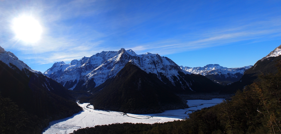
Past the Routeburn Flats Hut, the trail gets significantly steeper for about an hour as you climb through the bush and up towards the Routeburn Falls Hut. Midway along, you reach a point where a slip (i.e rock/land slide) has cleared the trees resulting in an epic view of the Humbolts Mountain Range.
It’s an idyllic spot, and a fantastic place to sit back in the sun and take in the awesomeness of the South Island’s Southern Alps.
The Humbolts (Pano, click to see full sized photo)
The Routeburn Falls Hut sits about 20 minutes further on. It’s a large hut that is an incredibly busy place in the summer months. In the winter, it’s another peaceful place to reflect on the views.
View from the Flats Hut
Over the winter months, it’s dangerous to go too far past the Routeburn Falls Hut. From here, it’s an alpine pass over the Harris Saddle and is known for frequent avalanches. I opted to go 15 or so minutes past the hut to the Routeburn Falls.
Near the Routeburn Falls
From here, another fantastic view back towards the Humbolts and down the Routeburn Valley…
The Humbolts Again (Pano, click to enlarge)
This day walk on the Routeburn Track took me just about four hours – yet this included me jogging about 50% of the time. If you were only walking, you’d want to allow 7 – 8 hours. Have you found the perfect mountain cocktail in New Zealand? Let us know in the comments section below. Interested in more walking or hiking opportunities in New Zealand? Check out these other NZ hiking experiences:
Kia Ora - I'm Matt. Adventurer, Instagrammer and New Zealand travel planning expert living in Queenstown, NZ. Founder of Planit NZ - New Zealand's largest travel planning & booking website.
Hello! I’m Matt. Thanks for checking out my blog. Be sure to follow me on Instagram for loads more New Zealand travel inspiration. Comment on one of my photos so I know you came from here!
This error message is only visible to WordPress admins
Error: There is no connected account for the user 1660330 Feed will not update.


")
")
")
")
")


 Backpacking Matt